AI · 31 Oct 2026 · 11:15 CET
Google Deepmind creates a global map of forests with satellite data and AI
Publisher preview · OZZZER analysis pending editorial review.
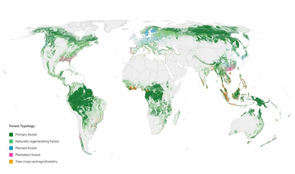
Google Deepmind and the World Resources Institute have developed ForTy, an AI map that distinguishes primary forests, timber plantations, and tree crop farms worldwide. Satellite maps usually show whether trees grow in a given area without identifying the forest or crop type. ForTy, short for Forest Typology, goes further by assigning the world's land area in 2020 to 6 classes at 10-meter resolution.
These cover primary forest, naturally regenerating forest, planted forest, plantation forest, tree crops such as oil palm, rubber, or cocoa, and other land. The authors say ForTy is the first global map of its kind. Earlier datasets, including one from the European Commission, cover only parts of the world. The main driver behind the project is the EU Regulation on Deforestation-free Products (EUDR), which prohibits goods linked to forests cleared or degraded after December 31, 2020, including goods produced after primary forest was converted to a plantation.
Oil palm and cocoa farms count as agricultural land, so companies assessing supply chain risks need to know how a site was used in 2020. ForTy gives them that 2020…
Excerpt supplied by the publisher.
Source
THE DECODER · 31 Oct 2026 · 11:15 CET
Open the original at THE DECODER ↗